Introduction
Finding water on Mars is a top priority for space agencies planning human exploration. Subsurface ice deposits could provide drinking water, breathable oxygen, and rocket fuel, but locating them with precision remains a challenge. Recent tests on Earth using drone-mounted radar over glaciers have demonstrated a powerful new method for mapping buried ice in remarkable detail, offering a blueprint for future Mars missions to choose exactly where to drill.

The Challenge of Finding Water on Mars
Mars is a dry, cold world, but evidence shows vast amounts of water ice exist beneath its surface, particularly in mid-latitude regions. While orbiters can detect broad areas of ice, they lack the resolution to pinpoint shallow deposits that are accessible for drilling. Drilling blindly would be risky and resource-intensive — a single misstep could waste valuable mission time and equipment.
Why Water Matters
Water is the cornerstone of sustainable human presence on Mars. It can be split into hydrogen and oxygen for fuel, used for drinking, and even for growing food. Every kilogram of water produced on Mars reduces the need to launch it from Earth, drastically cutting costs. Thus, identifying precise drilling locations is not just scientific curiosity — it is an economic and survival necessity.
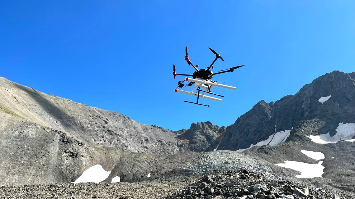
Drone-Mounted Radar on Earth
To test a solution, scientists turned to Earth’s glaciers, which mimic the cold, layered ice deposits found on Mars. They equipped lightweight drones with ground-penetrating radar — a technology that sends radio waves into the ground and measures reflections from buried layers. Flown at low altitudes, these drones can cover large areas quickly and map ice structures with unprecedented clarity.
How It Works
Radar waves penetrate snow and ice, bouncing off boundaries between different materials — such as ice and rock, or layers of clean ice and dust. By analyzing the time delay and strength of these echoes, researchers construct a 3D picture of subsurface features. The drone’s mobility allows it to fly in grids or patterns, creating high-resolution maps that reveal pockets of pure ice, buried crevasses, and even ancient flow structures.
Results from Glacier Tests
In trials over alpine glaciers, the drone radar detected ice layers as deep as 100 meters with a resolution of less than a meter. It successfully distinguished clean ice from debris-covered ice, a crucial distinction for Mars, where dust layers may hide water. The data allowed researchers to identify optimal drilling sites — places where ice is thick, pure, and easily accessible.
Implications for Mars Missions
The success on Earth opens a direct path to Mars. A similar drone — or even a small helicopter like Ingenuity — could carry a radar payload and survey candidate landing zones before a drilling mission arrives. This would transform the search for water from a guessing game into a targeted operation.
Selecting Drilling Sites
By flying over potential regions — such as Arcadia Planitia or Deuteronilus Mensae — a drone could map the depth, purity, and extent of subsurface ice. It could identify ice table boundaries, where ice begins just a few meters below the surface. This information would guide a lander’s robotic arm or drill to the most promising spots, increasing the chances of success and reducing wear on equipment.
Mission Concepts
Future missions could deploy a drone from a stationary lander or even from a rover. The drone would fly sorties, transmitting radar data back to Earth or to the lander for real-time analysis. This approach is fast, efficient, and low-risk, as drones can explore terrains that rovers cannot safely traverse, such as steep slopes or rocky fields.
Conclusion
Drone-mounted radar technology has proven its value on Earth, providing detailed maps of buried ice in glaciers. For Mars, this means we can soon pinpoint where to drill for water with confidence, turning a distant goal into a tangible plan. As space agencies gear up for human missions in the 2030s and beyond, such innovations will be key to establishing a sustainable presence on the Red Planet. The next time a drone buzzes over a glacier, think of it as a rehearsal for one of humanity’s greatest adventures: unearthing the water that will fuel our future on Mars.